
Category Archives for Kenya
Regrowing Kenya’s Forests
Kenya: The Price of Clean Energy
The Mangroves of Kenya
Kenya’s Water Wars
Kenya: Lake Turkana
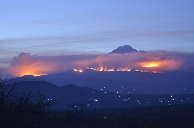
Fires shaped Mount Kilimanjaro’s unique environment. Now they threaten it
Thomas Becker/picture alliance via Getty Images
Andreas Hemp, Bayreuth University
In October, firefighters in Tanzania had to tackle a number of fires on Mount Kilimanjaro, Africa’s tallest mountain and the largest free-standing mountain in the world. The mountain and surrounding forests fall into Kilimanjaro National Park, named a UNESCO World Heritage site in 1987. Andreas Hemp provides a glimpse into the mountain’s natural environment and the challenges it faces.
Is this the first time there has been a fire of this magnitude? If there have been fires like this before, what damage was done to the mountain’s vegetation and how long did it take it to recover?
Fires are quite common in the higher areas of Kilimanjaro at the end of the dry seasons, around February to March and September to October. Fire can transform land cover, but it also maintains it. Studies that I’ve done with colleagues (using pollen records buried in the soil that go back 50,000 years) showed that fires always played a role in shaping the vegetation belts on the mountain.
For instance, certain species, such as the giant groundsels (Dendrosenecio) became fire-adapted. Also, without fires opening up the forests many light demanding species, such as the famous giant lobelias, would not be able to grow.
There have, however, been several severe fires on Kilimanjaro over the last few decades that have dramatically changed land cover.
Fires in 1996 and 1997 – years with unusually dry seasons – destroyed vast areas of old cloud forest. These are characteristically moist forests in high altitude areas which create unique environments. The forest was replaced by bush. Vegetation has started to recover and shrubs have sprouted, but it’s far from being a forest, which would take at least 100 years to grow without fire. Since these old forests have an important function of fog water collection, the loss of these forests means a serious impact on the water balance of the mountain, much larger than the impact of the melting glaciers, which is ecologically negligible.
The impact of these former fires was much bigger than that of the recent one, which “only” affected bush land and not forest.
What type of vegetation exists on Mt Kilimanjaro and how unique is it?
Due to its enormous height, Kilimanjaro has several distinct vegetation belts.
It is surrounded on the foothills by cultivation with a unique mix of agriculture, savanna and forest. This harbours very rich biodiversity as well as the tallest trees on the continent.
Higher up the mountain – between about 1,800 and 3,000 metres – a montane forest belt encircles the whole mountain. This is one of the largest forest blocks in East Africa.
Even higher up, between 3,000 and 4,000 metres, there’s a heathland belt typical of the high mountains in East Africa. This vegetation consists of Erica, Protea, Stoebe and many other shrub species, many of them are endemic, occurring only on one or several mountains.
Erica shrubs burn very easily, which makes this vegetation belt particularly flammable. During wet periods without fire, the former forest can re-establish and expand to the tree line at 4000m. During dry periods, with recurring fires (natural and or caused by people), the forest belt shrinks and the ericaceous belt expands.
What challenges does the mountain’s natural environment face and have there been any noticeable changes over the years?
Over the last 150 years, the regional climate has become drier. This has caused the mountain’s glaciers to shrink by almost 90% of their former extent. The drier climate is also the reason for an increase in the frequency and intensity of wild fires in the upper areas of Kilimanjaro, affecting the forests.
Most of these fires are lit by people (such as honey collectors smoking out bees), but these fires would not have been so devastating if the climate was wetter.
There’s an interplay between direct anthropogenic (caused by people) and climatic impacts.
Since 1911 the human population on Kilimanjaro has increased from 100,000 to over 1.2 million. This has resulted in an enormous loss of natural vegetation. Kilimanjaro is becoming an ecological island, isolated and surrounded by agriculture. Over this period it has lost 50% of its forest cover. In the lower areas this is mainly due to logging and clearing. In the upper areas it’s due to fires.
In combination with global climate change, this forest destruction results in a decrease of moisture in the region. This will also affect agriculture in the region because it’s partly irrigated.
Who is responsible for protecting the mountain and how well protected is it?
In 2005, the forest belt was incorporated into the mountain’s existing national park area. This means that it falls under the responsibility of the Tanzania and Kilimanjaro National Park authorities. The forest belt is much better protected than it was before, as a forest reserve.
The banning of camp fires on the tourist routes by the national park authorities helped to reduce the fire risk. But it’s not possible to exclude the risk in this large heathland belt totally. Perhaps the acquisition of larger fire-fighting airplanes could help. Fires are usually fought by hundreds of volunteers and firefighters, using shovels and machetes creating fire breaks by hand. This recent fire was the first time that a helicopter was used to carry water from nearby dams.
What else can be done?
To protect the biodiversity of Kilimanjaro the unique forests of the larger deep river valleys below the National Park should be incorporated into the National Park. Kilimanjaro is becoming an ecological island completely isolated and surrounded by agriculture. This inhibits the exchange of animal populations and affects biodiversity.
It’s all the more important that the wildlife corridor connecting the Amboseli ecosystem in Kenya and Kilimanjaro National Park has to be well protected. It is under great pressure due to grazing and agriculture. This corridor is important for the migration of elephants, which stay now more and more on Kilimanjaro destroying the forest.![]()
Andreas Hemp, Research Associate Plant Systematics, Bayreuth University
This article is republished from The Conversation under a Creative Commons license. Read the original article.
Africa’s Wildebeest Migration
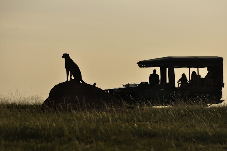
Why cheetahs in the Maasai Mara need better protection from tourists
Femke Broekhuis
Femke Broekhuis, University of Oxford
The global cheetah population is continuing to decline with only about 7000 individuals left in Africa. This is thought to be about half the population that existed 40 years ago. The decline has been caused by the loss and fragmentation of their natural habitats, a decline in their prey base, the illegal trade in wildlife as well as conflict with humans for space.
Cheetahs have disappeared from 91% of their historic range. This is hugely problematic as cheetahs are a wide-ranging species. To be viable a cheetah population needs a contiguous, suitable habitat which covers about 4,000–8,000 km2. But few protected areas in Africa are larger than 4,000 km2.
As a result, most of the cheetahs in the world – 77% – are believed to range outside protected areas. But this isn’t ideal for the animals as, from previous research we conducted using data from GPS satellite collars fitted on cheetahs in the Maasai Mara, we found that cheetahs avoid areas of high human disturbance and prefer protected, wildlife areas.
These results show the importance of wildlife areas for cheetahs, but my most recent research shows that these protected spaces have challenges of their own. We found that the number of cubs a cheetah is able to rear is lower in areas that receive lots of tourists compared with areas that are visited less. This suggests that cheetahs aren’t getting the protection they need, particularly from the impact of growing numbers of tourists.
Maasai Mara
Kenya’s Maasai Mara has one of the highest cheetah densities in the world, but it’s a landscape that is under increasing human pressure.
Famous for its spectacular wildebeest migration, the Maasai Mara is a popular tourist destination. The wildlife areas of the Maasai Mara include the Maasai Mara National Reserve, which is managed by the Narok County Government, and numerous wildlife conservancies, each run by different management companies.
The conservancies are formed through a partnership between Maasai landowners and tourism companies, whereby landowners receive a fixed, monthly payment for leasing their land for wildlife based activities on the condition that they do not live on the land, cultivate or develop it. Combined, the wildlife areas, which are predominantly used for photographic tourism, cover an area of about 2,600 km2 – one-tenth the size of Wales or Belgium.
During the high season about 2,700 people visit the Maasai Mara National Reserve daily. But they are often not adequately managed.
The Mara Reserve – with the exception of a conservancy called the Mara Triangle – doesn’t limit the number of tourists that enter the park per day, and there are no restrictions on the number of tourist vehicles at a predator sighting. It’s therefore not uncommon to see more than 30 tourist vehicles at a sighting.
Ideally, the Mara Reserve should restrict the number of tourists, especially during the peak tourist seasons.
Tourists also affect the landscape of wildlife areas. For example, tourist accommodation is continuing to increase in the Mara Reserve and these facilities are usually built on river banks which are prime habitats for species such as elephants, leopards and breeding raptors.
The research
One crucial element for a healthy cheetah population is cub recruitment, defined as offspring survival to independence.
Cheetahs have relatively big litters, ranging between one to six cubs. But cheetah cubs can succumb to various factors including abandonment, poor health, and fires so the number of cubs that reach independence can be very low, ranging from 5% to 28.9%.
I was interested in finding out if tourism is playing a role in this.
By analysing four years of data on female cheetahs with cubs it became apparent that high numbers of tourists are having a negative effect on the number of cubs that reach independence. More specifically, females in areas with a lot of tourists on average raised one cub (or none survive) per litter to independence compared to more than two cubs in low tourist areas.
There was no hard evidence of direct mortality caused by tourists. But my conclusion from my findings is that tourists are likely to have an indirect effect on cub survival. This could be because they lead to cheetahs changing their behaviour and increase their stress levels by getting too close, overcrowding with too many vehicles, staying at sightings for prolonged periods of time and by making excessive noise.
What can be done?
My study highlights the importance of implementing and enforcing strict wildlife viewing guidelines, especially in areas where tourist numbers are high. The Maasai Mara’s wildlife conservancies are largely getting this right. Tourist numbers are limited to the number of beds per conservancy and only five vehicles are allowed at a sighting at any given time.
Actions that could be taken include:
-
allowing no more than five vehicles at a cheetah sighting;
-
ensuring that no tourist vehicles are allowed near a cheetah lair (den);
-
ensuring that vehicles keep a minimum distance of 30m at a cheetah sighting;
-
ensuring that noise levels and general disturbance at sightings are kept to a minimum;
-
ensuring that vehicles do not separate mothers and cubs; and that
-
cheetahs on a kill are not enclosed by vehicles so that they can’t detect approaching danger.
If tourism is controlled and managed properly, it can play a very positive role in conservation. Money from tourism goes towards the creation and maintenance of protected areas – like the wildlife conservancies – and can help alleviate poverty. It also shows local communities the benefits that predators can bring and can positively influence attitudes.
![]() However if human pressures, like tourism, remain unchecked it risks having a negative impact on wildlife and could mean the loss of some of the biggest attractions – like cheetahs.
However if human pressures, like tourism, remain unchecked it risks having a negative impact on wildlife and could mean the loss of some of the biggest attractions – like cheetahs.
Femke Broekhuis, Senior research associate, University of Oxford
This article was originally published on The Conversation. Read the original article.
Technique developed in Kenya offers a refined way to map tree cover
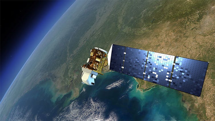
Flickr/NASA
Michael Marshall, World Agroforestry Centre (ICRAF)
Scientists at the World Agroforestry Centre in Nairobi, Kenya, recently pioneered a new approach which uses satellite images and maps to show patterns linked to land use and cover change on a yearly basis. Though the technique was developed in Kenya, it can be used regionally and potentially across the world.
“Land use and cover change” are terms used by scientists to define changes to the earth’s surface. This can be due to natural causes or because of the way in which land is put to use by people. Land use refers to what’s being done on it, for example mechanised farming, while land cover refers to what is physically on the land, for example what crops are being grown.
What’s important about the new approach is that the maps consist of an array of both physical and human geographic data to explain changes. It can also be used in combination with large-scale climate models, for example to understand how changes in vegetation in East Africa might be affecting climate in other regions of Africa.
In Kenya’s case, the system mapped changes in agriculture and natural vegetation with information from over a 30-year period. Using a series of aerial photographic surveys – which could be used to distinguish specific crops or natural vegetation – and freely-available spatial data such as rainfall, and population density, interpreters were able to classify Kenya’s land use and cover change. They were then able to construct maps of this change on a yearly basis without extensive and costly field visits typically used when mapping change.
Understanding land use and cover change is important because they both affect how land responds to the environment. Many of the changes are human-induced – for example the way that people use the land can lead to habitat loss, increase the stress of life that the land supports, affect greenhouse gas emissions and storage, modify runoff and ground water storage, or alter the climate.
Deforestation, perhaps the most well-known type of land use and cover change, comes about primarily from agriculture and logging. It has an impact on the world’s climate because trees store huge amounts of carbon that would otherwise be in the air trapping heat. The absence of trees therefore contributes to global warming.
Deforestation also affects people locally, particularly in the global south. Forests help regulate rainfall and water storage, and the help maintain a high level of biodiversity.
Much of the global north has seen an increase in tree cover in recent years. But much of the global south continues to show declines due to population growth, weak institutions and other social and ecological factors.
Mapping deforestation
To understand the drivers as well as the effects of deforestation, geographers use various tools that map the extent and density of tree cover. These include aerial photos, satellite images and other spatial data through time.
The World Agroforestry Centre’s approach takes this a number of steps further. It also uses demographic data, such as population density, which is often bypassed by scientists when mapping change.
The new approach suggests that physical drivers, like rainfall, may not be as important as previously thought.
Finally, the new technique provides a way forward for scientists interested in understanding what drives land use and cover change. It allows them to look at how this process interacts with processes like climate change over large areas and long periods of time.
From a scientific perspective, this helps us better to understand the environment and how humans may be modifying it. This in turn will help those designing land management strategies.
Kenyan case
Our research in Kenya shows that the most important predictor of land use and cover change was population density. Kenya is part of the East African Horn region. Like many other countries in Africa, its population is growing rapidly and is largely devoted to rain-fed subsistence agriculture and pastoralism.
Population growth occurred more rapidly in fertile areas, so the conversion of natural vegetation to agriculture was much higher. In less fertile areas, population growth was much slower, so the conversion was less.
Kenyan farmers and pastoralists are largely unable to acquire new land and are instead forced to intensify their practices on subdivided land.
We were able to detect that as the number of people per square kilometre increased, the amount of natural vegetation declined, because it was being replaced by farm or grazing land.
Climate predictors, such as rainfall and air temperature, were also correlated with the conversion of natural vegetation to agriculture, but less so compared to population density.
![]() As seen in the Kenya case, the growing demand for food in Africa must be met with effective land tenure reform. By mapping changes in our environment continuously over long time periods, farmers and policymakers can understand underlying mechanisms and explore opportunities for reform.
As seen in the Kenya case, the growing demand for food in Africa must be met with effective land tenure reform. By mapping changes in our environment continuously over long time periods, farmers and policymakers can understand underlying mechanisms and explore opportunities for reform.
Michael Marshall, Climate Change Scientist, World Agroforestry Centre (ICRAF)
This article was originally published on The Conversation. Read the original article.

You must be logged in to post a comment.